Champlain Park
A small residential neighbourhood between the Ottawa River and Scott Street, with its own park, wading pool and rink.
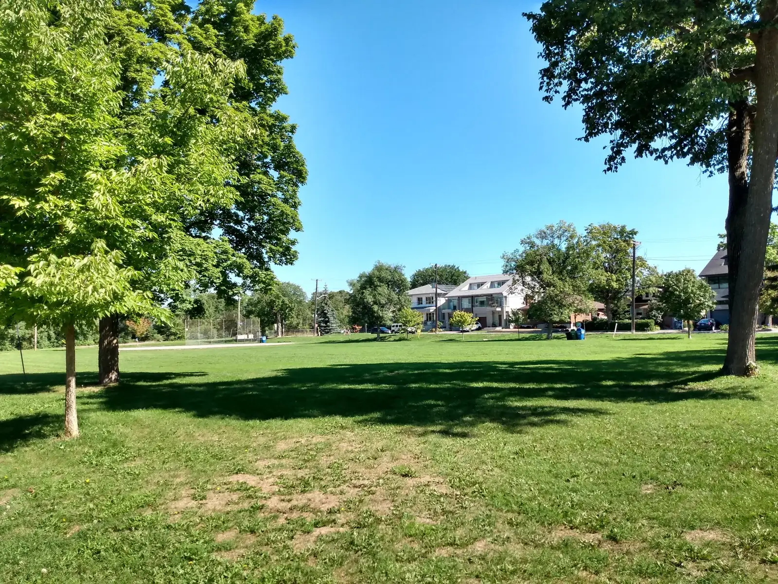
Champlain Park is an urban neighbourhood in Ottawa's Kitchissippi Ward, also known as Ottawa West. Population: 1,090 (2016).
Updated · Facts on this page link to their sources
About Champlain Park
Champlain Park is an urban neighbourhood in Ottawa's Kitchissippi Ward, also known as Ottawa West. Wikipedia places it between the Ottawa River and Scott Street, west of Tunney's Pasture and east of Island Park Drive and Westboro Beach. Champlain Park itself, at 140 Carleton Avenue, has a wading pool and an ice rink mapped within it. St. George School is on Keyworth Avenue. The 2016 census population was 1,090, per Wikipedia.
Boundaries
Wikipedia gives the boundaries as the Ottawa River to the north and Scott Street to the south; to the east is Tunney's Pasture, and to the west is Island Park Drive, as well as Westboro Beach. Neighbourhood lines are informal. openstreetmap.org
Homes
Wikipedia says most homes in Champlain Park were built in the 1920s and 1930s, with the last development in the 1950s. We have no census figures on housing type or tenure for this neighbourhood. en.wikipedia.org
- Champlain Park at 140 Carleton Avenue, with a wading pool and an ice rink
- Wikipedia lists the NCC bike path among the neighbourhood's recreation
- Westboro Beach is mapped just west of the neighbourhood
- Parliament Hill is about 4.2 km away in a straight line, or about 9 minutes by car in free-flow conditions
- St. George School (Ottawa Catholic School Board) is on Keyworth Avenue
- Most homes were built in the 1920s and 1930s, with the last development in the 1950s
Community
How Champlain Park came to be
- 1912
The area was part of the police village of Ottawa West from 1912 until Ottawa annexed it in 1949. The police village was bounded by Ottawa's city limits, the Ottawa River and the Britannia street car line. en.wikipedia.org
- 1920s
Most homes were built in the 1920s and 1930s, with the last development in the 1950s. en.wikipedia.org
- 1930s
In the 1930s Champlain Park was considered the west end of town. en.wikipedia.org
- 1949
Ottawa annexed the police village of Ottawa West, which included Champlain Park. en.wikipedia.org
- 1991
The community association was incorporated. en.wikipedia.org
Around Champlain Park
Walking rings at 5, 10 and 15 minutes from the neighbourhood centre.
Schools
8 nearbySt. George School
OCSB130 Keyworth Avenueopenstreetmap.org sge.ocsb.ca
250 m3 min walkCentre Jules-Léger
281 Lanark Avenueopenstreetmap.org ccjl.ca
750 m9 min walkHilson Avenue Public School
OCDSB407 Hilson Avenueopenstreetmap.org ocdsb.ca
830 m10 min walkChesterton Academy
415 Piccadilly Avenue Northopenstreetmap.org chestertonacademyofottawa.ca
870 m11 min walkElmdale Public School
OCDSB49 Iona Streetopenstreetmap.org elmdaleps.ocdsb.ca ocdsb.ca
1.2 km15 min walkFisher Park Public School / Summit Alternate School
OCDSB250 Holland Avenueopenstreetmap.org
1.4 km18 min walkBlyth Academy
352 Danforth Avenueopenstreetmap.org
1.5 km18 min walkChurchill Alternative School
OCDSB345 Ravenhill Avenue Eastopenstreetmap.org churchillalternative.ocdsb.ca ocdsb.ca
1.5 km19 min walk
Straight-line distances from the Champlain Park centre. Living near a school does not guarantee a place: confirm the designated school for an address with each board. All schools and board locators.
Parks & places
10 nearbyWading Pool - Champlain
Swimming pool
140 Carleton Avenueopenstreetmap.org
190 m2 min walkChamplain Park
140 Carleton Avenueopenstreetmap.org
230 m3 min walkChamplain Park Ice Rink
Ice rink
250 m3 min walkRemic Beach Complex
Nature area
155 Island Park Driveopenstreetmap.org
370 m5 min walkHeather Crowe Park
1902 Scott Streetopenstreetmap.org
520 m6 min walkMahoney Park
160 Lanark Avenueopenstreetmap.org
530 m7 min walkRiverside Terrace Park
225 Clearview Avenueopenstreetmap.org
660 m8 min walkSpencer Park
115 Spencer Streetopenstreetmap.org
890 m11 min walkPavillon Paul Dewar Field House
Community or recreation centre
29 Van Lang Privateopenstreetmap.org
1.0 km13 min walkLion's Park
294 Elmgrove Avenueopenstreetmap.org
1.0 km13 min walk
Shops & dining
10 nearbyMetro
345 Carleton Avenueopenstreetmap.org
630 m8 min walkStrawberry Blonde Bakery
111 Richmond Roadopenstreetmap.org
720 m9 min walkFarm Boy
317 McRae Avenueopenstreetmap.org
790 m10 min walkWellington Butchery
1333 Wellington Street Westopenstreetmap.org
800 m10 min walkWatsons
1308 Wellington Street Westopenstreetmap.org
860 m11 min walkBread By Us
870 m11 min walkCaramello Cafe
1305 Wellington Street Westopenstreetmap.org
870 m11 min walkReal Canadian Superstore
190 Richmond Roadopenstreetmap.org
930 m12 min walkMorris Home Hardware
1226 Wellington Street Westopenstreetmap.org
1.2 km15 min walkBatter Up
303 Richmond Roadopenstreetmap.org
1.2 km15 min walk
Getting around
TransitTunney's Pasture
O-Train
open1611 Scott Streetopenstreetmap.org
830 m10 min walkWestboro
Confederation Line
840 m11 min walkKichi Zìbì
Confederation Line
1.6 km20 min walkDowntown (straight line)
About 4.2 km in a straight line from the neighbourhood centre to Parliament Hill (downtown Ottawa).
Downtown (drive)
5.1 km and about 9 minutes by road to Parliament Hill (free-flow, no traffic; rush hour takes longer).
O-Train
Tunney's Pasture station (1611 Scott Street) is mapped as open; Wikipedia places Tunney's Pasture to the east of the neighbourhood.
O-Train
Westboro station (Confederation Line) is mapped as open.
For sale in Champlain Park
No Champlain Park homes on champlainpark.homes right now
Selling here? Get a website for your home, or browse every home for sale in the area.
Neighbouring areas
Quick answers
Short answers first; each links to the full answer and its sources.
Is Champlain Park a good place to live?
Champlain Park is a small, established neighbourhood in Ottawa's Kitchissippi Ward, bounded by the Ottawa River to the north and Scott Street to the south. It had 1,090 residents in the 2016 census, and most of its homes were built in the 1920s and 1930s. St. George School is about 0.25 km away in a straight line, and the neighbourhood's own park is about 0.23 km away.
As of 2026-10 · en.wikipedia.org openstreetmap.org
What schools serve Champlain Park?
St. George School, an English Catholic elementary school run by the Ottawa Catholic School Board (OCSB), is at 130 Keyworth Avenue. It is about 0.25 km from the neighbourhood centre in a straight line. Nearby public elementary schools run by the Ottawa-Carleton District School Board (OCDSB) include Hilson Avenue Public School and Elmdale Public School.
As of 2026-10 · openstreetmap.org sge.ocsb.ca
How far is Champlain Park from downtown Ottawa?
Champlain Park is about 4.2 km in a straight line from Parliament Hill, or 5.1 km by road. Free-flow driving time is about 9 minutes.
As of 2026-10 · router.project-osrm.org openstreetmap.org
What are homes like in Champlain Park?
Most homes in Champlain Park were built in the 1920s and 1930s, and the last development took place in the 1950s. The neighbourhood was part of the police village of Ottawa West until Ottawa annexed it in 1949.
As of 2026-10 · en.wikipedia.org
What is the nearest O-Train station to Champlain Park?
Tunney's Pasture station (1611 Scott Street) and Westboro station are both about 0.8 km from the neighbourhood centre in a straight line. Kichi Zìbì station is about 1.6 km away.
As of 2026-10 · openstreetmap.org openstreetmap.org
Where do people in Champlain Park buy groceries?
The closest listed grocery store is Metro at 345 Carleton Avenue, about 0.6 km from the neighbourhood centre in a straight line. Farm Boy (317 McRae Avenue) is about 0.8 km away, and Real Canadian Superstore (190 Richmond Road) is about 0.9 km away.
As of 2026-10 · openstreetmap.org openstreetmap.org